Role of Geostatistics in Geospatial Data Analysis
In today's world, the field of geospatial analysis is exploding, thanks to the vast amounts of data collected from sensors, satellites, drones, and everyday devices. But raw geographic data alone isn't enough-to extract meaningful insights requires robust statistical tools that respect the spatial nature of the data. That's where geostatistics comes in. In this article, we are going to explore how geostatistics enhances geospatial data analysis, what techniques it offers, and how it fits into the greater realm of spatial analytics.
Table Of Content
Why Geostatistics Matters in Geospatial Analysis
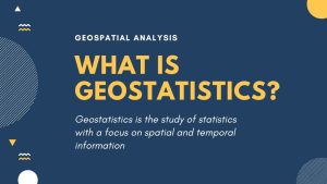
What is geostatistics with regard to geospatial data analysis?
Core Concepts: Variogram, Spatial Dependence & Interpolation
How Geostatistics Enhances Geospatial Data Analysis
Applications of Geostatistics in Geospatial Data Analysis
Integration with the wider geospatial analysis workflow
Challenges & Limitations in Applying Geostatistics to Geospatial Data Analysis
Future Trends: Geostatistics, Geospatial Analysis & Spatial Analytics
Frequently Asked Questions
Why Geostatistics Matters in Geospatial Analysis
What is geostatistics with regard to geospatial data analysis?
*GISGeography
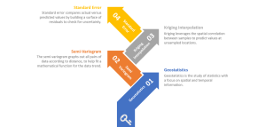
Model the way values change across space via variograms.
Use those models to make predictions at unmeasured points via kriging.
Quantify the uncertainty of those predictions.
These advances help your spatial analytics move beyond mere mapping to predictive, inferential insight.
Core Concepts: Variogram, Spatial Dependence & Interpolation
Variogram & Spatial Dependence
One key concept in geospatial data analysis is spatial autocorrelation, which suggests that the closer together two data points are, the more alike they are likely to be. The variogram is a function that describes how similarity varies with distance. By modeling this in geostatistics, you obtain insight into the spatial structure and can, therefore, apply proper spatial analytics.
Kriging & Interpolation
When carrying out geospatial analysis, one often finds oneself facing the following problem: you have measurements at some locations, but you need predictions at others. Geostatistical interpolation methods like kriging use the variogram model to deliver best-estimate surfaces and also provide measures of uncertainty. This is invaluable for meaningful geospatial data analysis.
*GIS Geography
How Geostatistics Enhances Geospatial Data Analysis
1. Handling Sparse Data & Prediction
In most geospatial data analysis projects, one may only sample a few locations owing to either cost or logistics. Geostatistics makes it possible to make an informed prediction for unsampled points, thus prolonging the reach of your spatial analytics.
2. Quantifying Uncertainty
Unlike simple interpolation in many geospatial analysis workflows, geostatistics can quantify the uncertainty of predictions. This enables decision-makers to understand not just the “what” but the “how reliable” in their geospatial data analysis.
3. Integrate auxiliary data
Typically, effective spatial analytics draw on multiple layers: terrain, geology, land use, climate. Geostatistics actually provides the framework for integrating those secondary data sets into predictive models, which will further improve your geospatial analytics results.
4. Improving Resource & Environmental Planning
Geostatistics raises geospatial data analysis in such sectors as agriculture, mining, water resources, and urban planning from just descriptive maps to predictive modeling for smarter decisions through refined spatial analytics.
Applications of Geostatistics in Geospatial Data Analysis
Natural Resource & Environmental Monitoring
For instance, geostatistical techniques can help in mapping soil nutrient levels, groundwater quality, or pollutant plumes across a region. In other words, this translates into better-informed environmental management through spatial modeling and spatial analytics of variability in the analysis of geospatial data.
Urban Planning & Infrastructure
You could, in the context of an urban setting, make use of geo-spatial analysis in determining optimal zoning, assessing the risk of subsidence, or modeling infrastructure stress. Geostatistics applies to the enhancement of geospatial data analysis to include prediction and uncertainty modeling, a critical dimension in modern spatial analytics.
Agriculture & Precision Farming
Farmers increasingly rely on geospatial data analysis to optimize inputs and yields. Geostatistics underpins this through the modeling of soil variability, yield prediction, and mapping crop conditions to make spatial analytics actionable at a fine geographic scale.
Public Health & Disease Mapping
In disease outbreaks, geo-spatial analyses help in the identification of clustering hotspots. By geostatistics, your geospatial data analysis will be able to quantify risk propagation and suggest interventions-strongly bridging into spatial analytics for health geography.
Integration with the wider geospatial analysis workflow
Data Acquisition & Pre-processing
First, gather location-tagged data (from sensors, remote sensing, and surveys) and prepare the data—clean it, project it, and check for anomalies. Without this careful step, any geospatial data analysis, including those using geostatistics, will be impaired.
Exploratory Spatial Analysis
Before modeling, you do some basic spatial analytics: plot, visually inspect, calculate summary statistics, and check for spatial autocorrelation. This sets the scene for the geostatistical modeling in your geospatial analysis.
Geostatistics for Model Building
Now comes in the geostatistics: variogram building, selecting kriging or other interpolation/simulation techniques, including auxiliary variables, and model validation. This forms the core of how to apply geostatistics to geospatial data analysis and is actually a rich area of spatial analytics.
Prediction, Mapping & Uncertainty
Once your model is built, you produce prediction surfaces, or maps, with accompanying uncertainty maps. The output is more than just descriptive: it’s actionable geo-spatial analysis, with insight delivered via geospatial data analysis and rigorous spatial analytics.
Interpretation & Decision-Making
Finally, the maps and predictions feed into decisions on where to place infrastructure, how to distribute resources, and which region is high-risk. The refined spatial analytics enabled through geostatistics means your geospatial data analysis has real impact.
Challenges & Limitations in Applying Geostatistics to Geospatial Data Analysis
Data Quality & Sampling
Poor sampling, data errors, and misprojections undermine geostatistical models. Without good quality input, your geospatial data analysis and spatial analytics outputs might be misleading.
Assumptions of Spatial Dependence
Similarly, the basic assumption of geostatistics is spatial autocorrelation – near things are more alike. In some geospatial analysis contexts, this may not hold. If it fails, then your model of spatial analytics may be inappropriate.
Computational Intensity & Complexity
Advanced geostatistical methods using multivariate kriging and large covariance matrices can be computationally expensive. For large-scale geospatial data, the high computational cost of spatial analytics can inhibit practical implementation.
Interpretation & Expertise
With any effective geospatial analysis, you have to interpret the results correctly; uncertainty maps, variogram models, predictions all require expertise. Without that, your spatial analytics may be misused or misunderstood.
Future Trends: Geostatistics, Geospatial Analysis & Spatial Analytics
The interplay between geostatistics and geospatial analysis will only deepen in the future, especially within the larger spatial analytics field.
Big Data & Machine Learning Integration
With the evolution in geospatial data analysis, geostatistics is being coupled with machine-learning to process large volumes of data, nonlinear relationships, and complex patterns. Such a hybrid approach to spatial analytics promises richer insights than traditional geostatistics alone.
Real-time & Dynamic Modelling
Geo-spatial analysis, in the IoT and streaming sensor world, tends towards being increasingly real-time. Geostatistics needs to evolve with dynamic, on-the-fly data changes for real-time geospatial data analysis and instantaneous spatial analytics.
3D and Spatio-Temporal Analytics
Beyond flat maps, modern geospatial data analysis deals with 3D data, such as subsurface modeling, and time-varying phenomena. Geostatistics is shifting to spatio-temporal methods and expanding the horizon of spatial analytics.
Decision-Support & Visualisation
Finally, actionable geospatial analysis depends on the communication of results. Visualizations, dashboards, and integrations into decision-support systems are the key parts of geospatial data analysis and spatial analytics in practice.
Frequently Asked Questions
An example of common geospatial data analysis is tracking land-use changes through satellite imagery. This kind of geospatial analysis aids in environmental monitoring and urban planning through spatial analytics.

